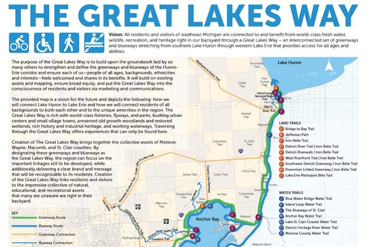
Great Lakes Way project aims to unify greenways and water trails along Michigan’s southeast coast
A new effort is underway to establish a world-class land and water trail running along Michigan's lower eastern coast.
This article is part of Inside Our Outdoors, a series about Southeast Michigan’s connected parks, greenways, and trails and how they affect residents’ quality of life. It is made possible with funding from the Michigan Trails and Greenways Alliance.
The Community Foundation for Southeast Michigan (CFSEM) has its sights set on a bold new plan to establish a world-class land and water trail running along Michigan’s lower eastern coast.
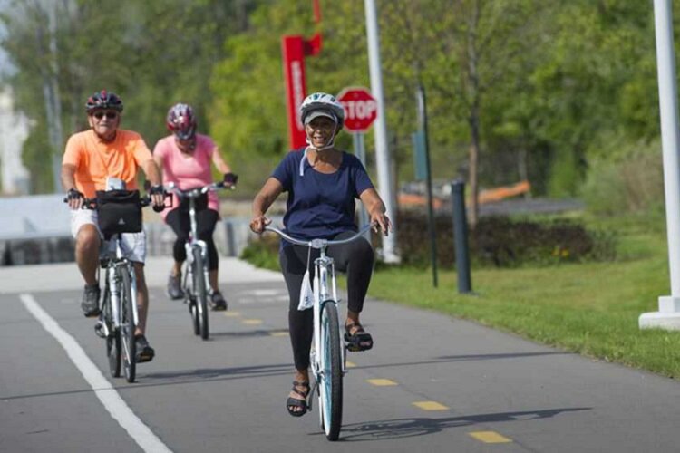
Through its GreenWays initiative, the philanthropic nonprofit has long been a backer of biking and walking infrastructure, helping to fund the creation of more than 100 miles of linked trails in the region over the last two decades. Now it’s developed a vision for the Great Lakes Way, an interconnected set of blueways and greenways. The project would include 156 miles of water trails and 160 miles of non-motorized land trails, stretching from southern Lake Huron to western Lake Erie.
While CFSEM is spearheading the project, it’s receiving guidance from an advisory committee of community leaders that includes representatives from the Southeast
Michigan Council of Government’s (SEMCOG), the Michigan Trails and Greenways Alliance, River Raisin National Park, MotorCities National Heritage Area, Downriver Linked Greenways, the Detroit Riverfront Conservancy, Wayne County Parks, and Macomb County.
The idea behind the Great Lakes Way is to bring together existing land and water pathways along Michigan’s southeastern coast into a nationally significant consolidated trail system that’s accessible to people of different ages and abilities.
“Many of the communities along that corridor have been developing greenways or water trails — not least of which are initiatives as the Detroit Riverfront, or the Bridge to Bay Trail or the Downriver Linked Greenways,” says Tom Woiwode, director of the CFSEM’s GreenWays Initiative. “It is our hope that the Great Lakes Way will bring them all together under a unified vision that, by virtue of those connections, amplifies both the vision and the effect.”
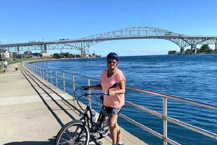
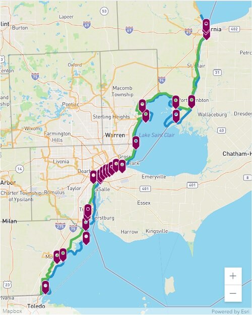
The proposed project lays out two roughly parallel routes along Michigan’s coast in St. Clair, Macomb, Wayne and Monroe counties. The land route would incorporate sections of the Bridge to Bay Trail, Jefferson Path, Iron Belle Trail, and the Lake Erie Metropark bike trail. The water route would link together paths along the region’s lakes and rivers like the Monroe County Water Trail and the Anchor Bay Water Trail. Although many of those projects are already completed or underway, backers of The Great Lakes Way hope that they can raise the trails’ collective visibility by joining them under a common banner.
CFSEM sees the effort as an opportunity to help southeast Michigan become the No. 1 freshwater recreation destination in the U.S. Through the project it also wants to help promote outdoor recreation, spur economic development, celebrate historical and cultural assets, promote conservation and environmental awareness, and support healthy ways of living.
Right now, the project is still in the vision phase. Last month, CFSEM launched a website and released a map outlining the proposed land and water routes, as well as intersecting infrastructure like the Joe Louis Greenway, the Clinton River Water Trail, and points of interest like the Fort Gratiot Lighthouse and Historic Fort Wayne.
The foundation is currently raising funds and identifying catalytic projects to move the endeavor forward.
Author

Related Articles

Michigan Adventurer to Bike 1,000 Miles Across State to Spotlight Hidden Form of Domestic Abuse
A Michigan adventurer is biking over 1,000 miles across both peninsulas this summer to raise awareness about economic abuse: a hidden form of domestic violence that affects countless survivors across Michigan.

Detroit schools are making real gains in reading and math: 4 strategies that are working
The city’s schools are making progress faster than peer districts, but that progress could be fragile.

From brunch to wellness, here are some ways to celebrate Mother’s Day in Detroit
From brunch and dinner specials to wellness and healing-centered experiences, several Detroit businesses are offering plenty of ways to celebrate Mother’s Day.
