Resilient Neighborhoods: This Detroit neighborhood is using tech to tell the story of its housing
A Detroit nonprofit is taking an innovative and interactive approach to sharing the history of the neighborhood it serves.
Woodbridge resident Mark Jones has always been curious about history, but lately he’s been applying his interest to his own neighborhood.
Jones works as a data analyst with the city of Detroit and previously held a similar position with the Southeast Michigan Council of Governments. His specialty is working with geographic information systems (GIS), computer-based tools that can be used to collect, display, analyze, and interpret geographic data.
Working with Woodbridge Neighborhood Development (WND), a local nonprofit, Jones recently created an online presentation known as a story map that uses GIS technology to help tell the story of housing in Woodbridge.
The History of Woodbridge Housing project looks at how the built environment in Woodbridge started, how it has grown, how it has been affected by policy decisions — especially urban renewal which began in the 1940s and lasted decades — and resident efforts to preserve housing in the community.
The story map was released in April. Rather than just letting users scroll through a bunch of text and images about this history, however, the map allows viewers to engage with an interactive narrative that includes elements like clickable map locations, newspaper articles and advertisements, and old film clips.
“This is kind of the new way that city planning is going, and that’s my niche,” says Jones. “So I’ve just been trying to figure out a way to implement it and make all of the cool things that Woodbridge has done interactive.”
Learning from history
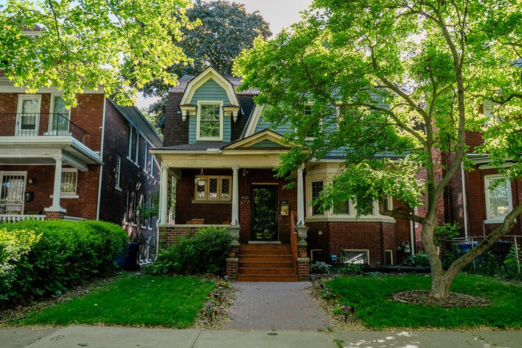
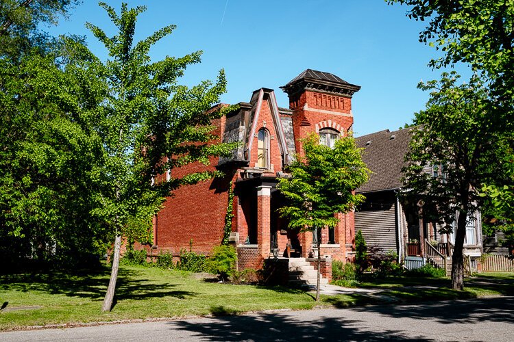
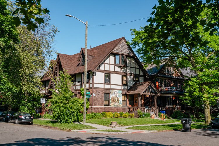
Located in the southern central part of Detroit, Woodbridge is a historic neighborhood known for its many Victorian homes. WND is a community development organization that serves the area’s residents. The resident-driven nonprofit was established in 2002 to address community housing and development needs. It’s particularly focused on the physical redevelopment of Woodbridge and committed to keeping the neighborhood mixed-income and multi-generational.
.
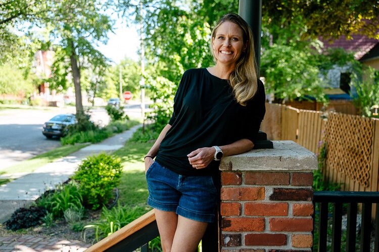
According to Christine Holmes, Woodbridge Neighborhood Development’s Policy and Property Development Director, the idea for the story map came about as a result of WDN working with residents on its housing guidelines for unused and underutilized areas in the community.
“We worked with our neighbors to discuss things around development that they liked and things they didn’t like, because our neighborhood has experienced an
influx of new housing development,” she says. “We got a lot of insight from neighbors about what used to be here, and we were all very intrigued by that.”
Not long after that, WND began speaking with Jones — who had already worked with the group on a few minor map projects — about how they could use his skills to share this history with others.
“I had some ideas over COVID on ways to improve the website,” he says. “We started talking and they suggested maybe a history project. And I was all about that.”
At the time, Esri, a company that specializes in GIS and mapping software, had just come out with a series of online templates for making story maps. Jones really liked the format of those templates, so he started using those tools to create an interactive history of Woodbridge’s housing.
The story map’s content has been compiled using publicly available historical and reference materials, as well as the contributions of Woodbridge residents. It tells the story of housing and development in Woodbridge from the arrival of French settlers to the present day.
Topics covered include the neighborhood’s humble beginnings as a ribbon farm, early development by the Hodges Brothers for industrialists and wealthy professionals, rapid growth during the 1920s, the establishment of working-class housing, efforts to demolish existing buildings to make way for new development, resident pushback to urban renewal efforts, and contemporary housing developments.
With all the changes taking place in Woodbridge now, Jones is hopeful that newer residents will take the time to check out the story map and learn more about the history of their neighborhood and the struggles that have taken place to preserve it.
“If it wasn’t for the neighbors that are leaving or retiring or passing away, then these houses wouldn’t stand anymore, including the house I live in,” he says. “It’s because of their efforts in the past that we can appreciate this cool neighborhood now.”
Keeping the past alive
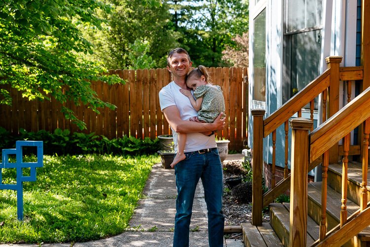
Jodi Trombley, a business developer with Amazon corporate, has lived in the Woodbridge neighborhood since 2015. Several years back, the mother of three tried to research her own home with her husband, but they found that to be a difficult endeavor. Having seen the story map, she considers herself a fan.
“Even on my phone, it was really cool to see the overlays of the original mapping, the outline of Woodbridge, and how it updated and highlighted the different streets,” she says. “The story map really did a good job of giving you a framework of the whole neighborhood and how it developed, and then you could see how your own property fit into that.”
After reading about the story of housing development in her neighborhood, Trombley was surprised to learn residents 100 years ago were dealing with similar
issues to the present day like trying to balance different types of housing to meet the needs of working-class families and more affluent people. She’s also appreciative of the work WND is doing to preserve the story of how the community developed.
“I think Woodbridge has a strong community and it’s helped this neighborhood a lot,” says Trombley. “I’m glad to see them investing in that history and sharing that knowledge with the rest of us.”
In addition to the story map, WND is also in the process of making even more history available to residents and others who are curious about the historic neighborhood.
“We have a number of historic documents that we’ve been aggregating over the years. So we worked with the Detroit Historical Society to archive those documents,” says Holmes. “And we are finalizing an oral history project with a number of longtime Woodbridge neighbors and some people who have lived here during the time of urban renewal.”
The archives are currently cataloged online, and the oral history project is expected to be completed in the next few months.
Photos by Nick Hagen.
Resilient Neighborhoods is a reporting and engagement series that examines how Detroit residents and community development organizations are working together to strengthen local neighborhoods. It’s made possible with funding from the Kresge Foundation.
Author

Related Articles

Michigan Adventurer to Bike 1,000 Miles Across State to Spotlight Hidden Form of Domestic Abuse
A Michigan adventurer is biking over 1,000 miles across both peninsulas this summer to raise awareness about economic abuse: a hidden form of domestic violence that affects countless survivors across Michigan.

Detroit schools are making real gains in reading and math: 4 strategies that are working
The city’s schools are making progress faster than peer districts, but that progress could be fragile.

From brunch to wellness, here are some ways to celebrate Mother’s Day in Detroit
From brunch and dinner specials to wellness and healing-centered experiences, several Detroit businesses are offering plenty of ways to celebrate Mother’s Day.
